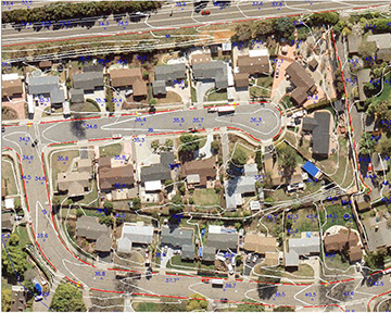
The digital orthophoto process transforms a vertical aerial photograph into the equivalent of a traditional map. Yet it retains the advantages of a photograph—visually displaying actual cultural and land features, and the built environment, rather than representing those features using symbols and lines.
The quality of a digital orthophoto is dependent upon the quality of each step in the process. For example, it is essential to start the process with good imagery and accurate input data, rather than proceeding, and trying to repair flawed imagery later. Because of our attention to quality outputs, Central Coast Aerial Mapping Inc. will provide you with accurate and visually appealing orthophotography, and do so in your preferred data format.