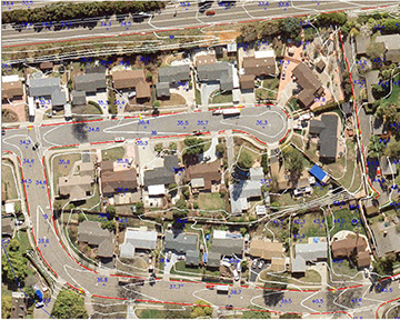
Rather than just provide a point cloud or orthophotos, we are able to produce full 3D stereo line work with drone imagery using stereo photogrammetry.
Utilizing our custom made drone with survey grade centimeter accuracy we are able to produce a full 3D vector line work from drone imagery as shown in the samples below.